

Things To Do
San Isabel National Forest is a sprawling, disjointed unit, consisting of three distinct mountain ranges across a million acres of the Rockies. From the headwaters of the Arkansas River above Leadville to the craggy Sangre de Cristo Mountains to the verdant Wet Mountains, the forest ranges in elevation from 5,860 feet to 14,433 feet.
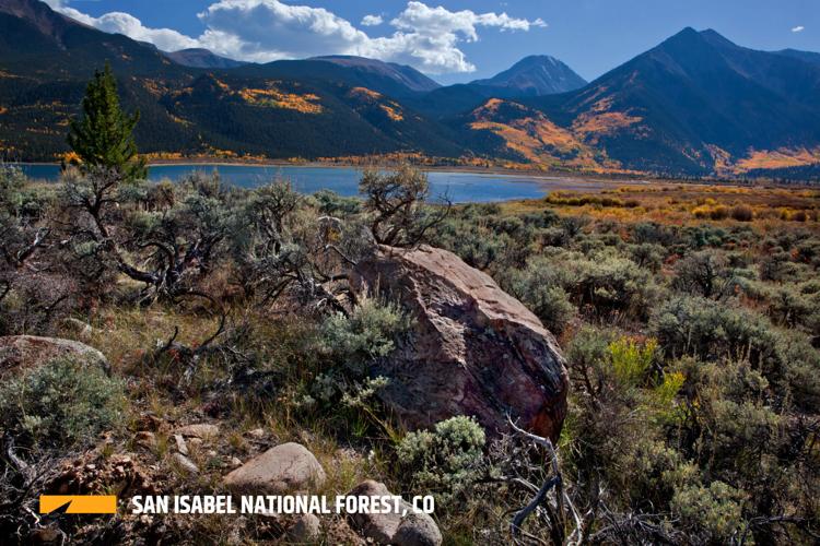
High in the Sawatch Mountains, the forest is a mountain-climber’s paradise. With the exception of Mount of the Holy Cross, the entire range – on the east side of the Divide – lies within San Isabel National Forest. So that means 14 mountains above 14,000 feet live here, including Colorado’s three highest: Mounts Elbert, Massive, and Harvard. These are huge, bulky mountains, rising dramatically above the Arkansas River Valley, all of which can be climbed on simple trails with no need for ropes. The natural forces that built them left faults that allow geothermally-heated water to well up, so there are several commercial hot springs to soak sore legs after a climb.
All roads through the Sawatch close come winter, so outdoor recreation in the area is limited. Cottonwood Pass is a popular snowmobiling and cross-country skiing area, but visitation is far, far less than in summer. However, U.S. Highway 50 remains open year-round over Monarch Pass, and that’s where you’ll find the forest’s sole ski area. Monarch Mountain has one of the highest base areas in Colorado and all-natural snow. A favorite among Colorado Springs skiers, Monarch offers affordable prices and lift lines are rare. The area is small and lacks the frills and glitz of the mega-resorts, but that’s just fine for the skiers who call Monarch home.
Leaving the Sawatch behind, the Arkansas River turns east. Here San Isabel National Forest spreads southeast into the Sangre de Cristos. This range is jagged and narrow, just a few miles across in places. Few roads brave its heights, and most of the forest is part of the Sangre de Cristo Wilderness. It’s a landscape of steep, narrow valleys, pretty alpine lakes, and forbidding peaks. Some of Colorado’s most dangerous fourteeners can be found here, including Crestone Needle and Crestone Peak. Danger brings those in search of an adrenaline rush, and the fourteeners here are immensely popular.
Across the valley floor to the east lie the Wet Mountains, one of Colorado’s lowest ranges. The only point that rises above timberline is Greenhorn Mountain, named for the Comanche chief who dared to challenge the Spanish and perished in battle near here. The national forest recreation through here consists mainly of dirt roads and ATV trails, though the Greenhorn Wilderness offers an easy hike to the summit of the namesake peak with great panoramic views of southern Colorado.
The national forest reaches its southern terminus in the Spanish Peaks region. These twin peaks were sacred to the Native Americans, who called them the “breasts of the world” as well as an important guide point on the Santa Fe Trail. Both can be climbed in a half-day, though West Spanish Peak is the easier of the two, despite its greater height.
Pro Tips
Our Favorite Trails
Other Notable Places
Recommended season(s): Year-round.
—R. Scott Rappold


(0) comments
Welcome to the discussion.
Log In
Keep it Clean. Please avoid obscene, vulgar, lewd, racist or sexually-oriented language.
PLEASE TURN OFF YOUR CAPS LOCK.
Don't Threaten. Threats of harming another person will not be tolerated.
Be Truthful. Don't knowingly lie about anyone or anything.
Be Nice. No racism, sexism or any sort of -ism that is degrading to another person.
Be Proactive. Use the 'Report' link on each comment to let us know of abusive posts.
Share with Us. We'd love to hear eyewitness accounts, the history behind an article.