It’s going to be quiet on the slopes for an extended period of time, but more winter weather is on the way.
The National Weather Service says dry weather will stick around Monday and Tuesday with clouds present Wednesday and Thursday. Heavy mountain snow is expected above 6,000 feet, with a mix of rain and freezing drizzle across the valley areas.
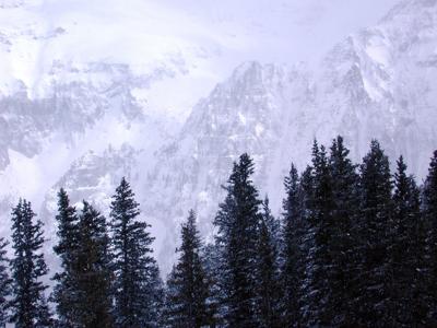
#cowx #utwx pic.twitter.com/m8BcHdaVdS — NWS Grand Junction (@NWSGJT) March 16, 2020
According to Joel Gratz of OpenSnow, Colorado could see anywhere between 10 to 18 inches of snow by the time the multiple storms pass through parts of the state, from Wednesday afternoon into Friday. The southern mountains, mountains near and west of Aspen and Crested Butte, areas near and east of the continental divide and near and north of I-70 are expected to receive the most snow. To see additional information about this forecast from OpenSnow, click here.
Gov. Jared Polis announced Saturday that all ski resorts in the state would close until March 22 in an effort to stop the spread of coronavirus. In response to the growing outbreak, some mountain county residents and visitors are being advised to “minimize all contact with other people, whether or not they are experiencing symptoms.”
RELATED: Here’s where COVID-19 is currently found in Colorado
If you’re headed the mountains, you may want to reconsider due to COVID-19. Travel to the high country is being strongly discouraged right now, especially for anyone older than 60 or those at high risk with underlying health conditions.
Local Forecasts
Here are a few local forecasts from around the state, according to the National Weather Service:
Denver will see a few chances of rain this week, and then snow hitting on Thursday and possibly Friday. Temperatures will be warm in the 50s and 60s before a cold front brings them down to the 40s and 30s.
Colorado Springs could also see some rain this week before snow hits Thursday to Friday. Temperatures will range from the 60s to 50s, before cooling off into the 30s and 40s.
Breckenridge will see plenty of fresh powder, with snow showers hitting from Wednesday to Friday. Temperatures will range from the 40s to 30s, with evening dips into the 20s.
Vail will be sunny until the snow rolls in from Wednesday to Friday, with temperatures ranging falling from the 50s to the 30s.
Crested Butte is looking at temperatures set in the 40s this week, followed by back-to-back powder days from Wednesday to Friday. Temperatures will fall into the 20s and mid-teens amid the storm.
RELATED: Click for more WEATHER news
Editor’s Note: All weather statements and snow accumulations are subject to change. Check the official Colorado Department of Transportation website for up-to-date information on road conditions and the National Weather Service for updates on incoming storms. For your mountain forecast, we recommend visiting OpenSnow. For daily avalanche conditions, always check with avalanche.state.co.us before heading into the backcountry.


(0) comments
Welcome to the discussion.
Log In
Keep it Clean. Please avoid obscene, vulgar, lewd, racist or sexually-oriented language.
PLEASE TURN OFF YOUR CAPS LOCK.
Don't Threaten. Threats of harming another person will not be tolerated.
Be Truthful. Don't knowingly lie about anyone or anything.
Be Nice. No racism, sexism or any sort of -ism that is degrading to another person.
Be Proactive. Use the 'Report' link on each comment to let us know of abusive posts.
Share with Us. We'd love to hear eyewitness accounts, the history behind an article.