“If you are in the mountains, stay there, and if you are on the Front Range, stay there,” tweeted out the Town of Frisco during a call with the Colorado Department of Transportation.
The tweet came amid safety concerns and major travel disruptions around the state, with a total of seven consecutive days of snow in the forecast for parts of Colorado.
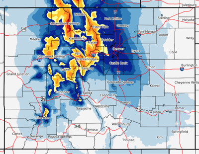
An ongoing winter storm is expected to bring up to 18 inches of snow to the state through Friday night, accompanied by winds gusting up to 65 miles per hour. According to the National Weather Service, snowfall rates could range from 1 to 2 inches per hour during this time.
It’s a 250 mile long, 5.5 mile wide band on the southern Colorado radar. #badass #ImpossibleToForecast pic.twitter.com/0Oxkf7Azey — Matt Meister (@TheWxMeister) February 7, 2020
OpenSnow is reporting that a 12-hour break in the snowfall will likely happen on Saturday, followed by an additional 3 to 8 inches of snow on Saturday night with more snow possible on Sunday.
CDOT is recommending that people stay where they are now through at least Saturday or possibly even into Monday.
Following this next wave, even more snow will be on the way, with some ski towns, like Crested Butte, expecting a total of 7 consecutive days of snow. According to forecasters at OpenSnow, Steamboat, Arapahoe Basin, Loveland Ski Area, and Eldora could see 20 inches of snow over the next 5 days.
The National Weather Service has issued several winter storm warnings and advisories for many parts of the state with mention of difficult to impossible travel.
Avalanche dangers are also on the rise with an active warning in place from 5:00 AM Friday through 8:00 AM Saturday for Aspen, Gunnison, and Sawatch Zones. The avalanche danger is high (Level 4 of 5), with slides likely to occur that are large enough to bury or kill a person likely to occur.
Here are a few local forecasts from around the state:
Silverton is looking at some powder days with flakes falling on Friday, Sunday, Monday, Tuesday, Wednesday, and Thursday.
Vail is expecting snow showers until midnight on Friday, with snow picking up again on Saturday and Sunday. There’s also a slight chance for some even more fresh flakes to carry throughout the rest of the week likely hitting from Monday through Thursday.
Crested Butte is looking at back-to-back powders with seven consecutive days of snow falling from Friday to Thursday.
Breckenridge can expect a full week of fluff with snow coming down from Friday to Thursday.
Telluride will likely get plenty of snow on Friday, with sunny skies on Satruday before snow returns again for the remaining of the week through Saturday. Temperatures will vary greatly from the high 30s to the low teens.
Denver could get hit with chances of snow falling on Friday, Saturday, Sunday, Monday, Wednesday, and Thursday.
Colorado Springs may also catch a few of the flakes, with snow hitting on Friday, Sunday, and Monday.
See a few tweets about the weather in Colorado below:
Bands of heavy snow will continue across the mountains, foothills, adjacent plains and Palmer Divide through the afternoon. Snowfall rates up to 2 inches per hour will be possible with the heavier bands. #cowx pic.twitter.com/PQP4pJwNhl — NWS Boulder (@NWSBoulder) February 7, 2020
Eisenhower Tunnel. Why would you want to be here? Stay out of the mountains. Closures likely! Photo from CDOT#cowx pic.twitter.com/KEJvGik06x — NWS Boulder (@NWSBoulder) February 7, 2020
On a call with CDOT right now & they are recommending that folks stay where they are through at least tomorrow morning & likely even into Monday. If you are in the mountains, stay there, and if you are on the Front Range, stay there. Another storm is coming tomorrow. https://t.co/34TkQTr1Tk — Town of Frisco Government (@TownofFrisco) February 7, 2020
If traveling, be prepared for extreme winter weather conditions and extended road closures. Avalanche mitigation efforts are scheduled to take place on Monarch Pass Friday from 4:30 PM to 6:30 PM. Before you head out, always check the road conditions at Cotrip.org and pack your trunk with these winter survival essentials.
If you must travel today across southeast Colorado, before you leave, make sure and check the latest forecast updates at https://t.co/pZtSo4uzlK as well as checking the road conditions at https://t.co/SrpgUv7eAa #cowx pic.twitter.com/GeQGMj10xc — NWS Pueblo (@NWSPueblo) February 7, 2020
RELATED: Click for more WEATHER news
Editor’s Note: All weather statements and snow accumulations are subject to change. Check the official Colorado Department of Transportation website for up-to-date information on road conditions and the National Weather Service for updates on incoming storms. For your mountain forecast, we recommend visiting OpenSnow. For daily avalanche conditions, always check with avalanche.state.co.us before heading into the backcountry.


(0) comments
Welcome to the discussion.
Log In
Keep it Clean. Please avoid obscene, vulgar, lewd, racist or sexually-oriented language.
PLEASE TURN OFF YOUR CAPS LOCK.
Don't Threaten. Threats of harming another person will not be tolerated.
Be Truthful. Don't knowingly lie about anyone or anything.
Be Nice. No racism, sexism or any sort of -ism that is degrading to another person.
Be Proactive. Use the 'Report' link on each comment to let us know of abusive posts.
Share with Us. We'd love to hear eyewitness accounts, the history behind an article.