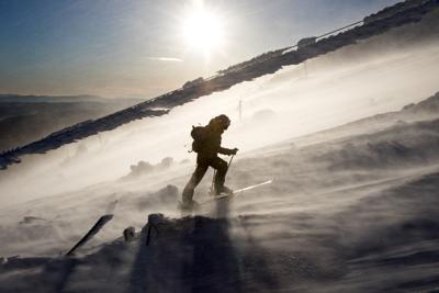
Heavy snow and extremely strong, gusty winds will continue to whisk through the mountains, resulting in hazardous travel conditions lasting through Friday evening.
According to the National Weather Service, the highest powder totals of 5 to 10 inches will hit north of Rabbit Ears Pass, with most mountain ranges expecting snow of 5 to 8 inches. Winds howling up to 85 mph will be added to the wintry mix, causing reduced visibility to near zero at times due to areas of blowing snow. Damage to trees and possible power outages may also occur.
Snow is moving into the mountains, with the heaviest snow expected over Grand and Summit counties, as well as the Medicine Bow mountains over the next couple hours. #Lightning has been observed NW of Steamboat – outdoor enthusiasts should use caution. #cowx pic.twitter.com/m6IZ3QAsbp — NWS Boulder (@NWSBoulder) January 17, 2020
Areas impacted by snow and wind include Rabbit Ears Pass, Rocky Mountain National Park Summit County, Indian Peaks, Gore and Elk Mountains, Central Mountain Valleys, West Elk and Sawatch Mountains, Flat Tops, San Juan Mountains, Kenosha Mountains, Mount Evans, Williams Fork Mountains, Winter Park, Columbine, Hahns Peak, Toponas, Aspen, Vail, Snowmass, Crested Butte, Taylor Park, Marble, Buford, Trappers Lake, Telluride, Ouray, Breckenridge, Winter Park, and Lake City.
Looking ahead, Joel Gratz of OpenSnow is forecasting the next chance for powder from Wednesday into Thursday, January 22-23.
Numerous crashes and spinouts have been reported on slick roads and mountain passes across the state. Highway 287 (between Springfield and Lamar) closed in both directions early Friday morning due to adverse conditions.
Conditions deteriorating in the mtns from W to E. Mod/heavy snow will reduce vis, impacting travel. Gusts of 50-60mph this aftn/evng. #cowx pic.twitter.com/elcLUl2vSj — NWS Boulder (@NWSBoulder) January 17, 2020
If you plan on traveling, expect possible road closures and delays in the mountains. Chain and traction laws are also in place throughout the state, you can find alert with the Colorado Department of Transportation. Stay safe and enjoy the snow!
RELATED: Click for more WEATHER news
Editor’s Note: All weather statements and snow accumulations are subject to change. Check the official Colorado Department of Transportation website for up-to-date information on road conditions and the National Weather Service for updates on incoming storms. For your mountain forecast, we recommend visiting OpenSnow. For daily avalanche conditions, always check with avalanche.state.co.us before heading into the backcountry.


(0) comments
Welcome to the discussion.
Log In
Keep it Clean. Please avoid obscene, vulgar, lewd, racist or sexually-oriented language.
PLEASE TURN OFF YOUR CAPS LOCK.
Don't Threaten. Threats of harming another person will not be tolerated.
Be Truthful. Don't knowingly lie about anyone or anything.
Be Nice. No racism, sexism or any sort of -ism that is degrading to another person.
Be Proactive. Use the 'Report' link on each comment to let us know of abusive posts.
Share with Us. We'd love to hear eyewitness accounts, the history behind an article.