


The three waves of snow over seven days event turned mostly into a one wave over two days event for Colorado, but snow accumulated approximately to the forecasted levels regardless.
Colorado's skiers and riders begin Monday with a powder day at several ski areas and resorts and not just in the southern mountains like on Sunday.
Snow totals range between 7-14 inches in the southern mountains, 4-15 inches in the central mountains and 3-14 inches in the northern mountains.

A Weather.us forecast map from the ECMWF model shows the potential total accumulation levels of water-equivalent precipitation as of 9 a.m., Monday, March 25 for Colorado. Depending on the density of the snow, one inch of water is equivalent to 10 inches of snow based on a common rule of thumb ratio of 10:1.
The ECMWF high resolution model from Sunday morning mimicked the snow totals around the state rather accurately too.
Recap:
Heavy snow started falling early Sunday in the southern mountains — like seen at Wolf Creek (now over 300" for the season) shortly after lifts began spinning at 8:30 a.m. — and spread northward throughout the day, with snow arriving on upsloping winds in the eastern mountains around 1:30 p.m.

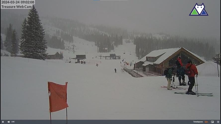
View from the Treasure Web Camera Sunday, March 24 at 9:02 a.m. at Wolf Creek Ski Area. Snow began falling Saturday, March 23 at the ski area in southwestern Colorado to start a multi-day storm with up to 3 feet of snow potentially by March 30, 2024.
A forecasted low pressure system moved over southeastern Colorado Sunday afternoon, enhancing wrap-around moisture from the northeast to the eastern mountains.
Around 5 p.m. the winds shifted direction pushing moisture back into Colorado from out east.

Satellite imagery of over the northern Rockies states between 12:11 a.m., Sunday to 8:06 p.m., Sunday.
By 8 p.m., nearly 8 inches was on the snow stake at Eldora Mountain Resort in Boulder County.

Snow accumulates on the snow stake web camera, as seen at 8:30 p.m., Sunday, March 24, 2024, at Eldora Mountain Resort in Boulder County, Colorado
Monday's first chairs will offer ample new snow with snow tapering off through mid-morning and fairly colder temperatures after the cold front moved through with the storm. Highs today will be in the teens to low 20s.
Forecast:
On Tuesday and Tuesday night, left over flurries and isolated showers will flutter around, but most likely lead to little accumulations (3-5") for Wednesday's first chairs, as the low pressure system moves eastward into Iowa.
Wednesday through Saturday will offer mostly sunny skies, temperatures back into the 20s and 30s — warming a few degrees each day — before a new storm takes aim at Colorado, potentially beginning as early as Sunday.
Long Range:
The ECMWF synoptic composite model forecast for Monday, April 1 has yet again an area of low pressure spinning off the southern California coast, pumping moisture into the southwest.

A Weather.us forecast map from the ECMWF model shows the synoptic composite of wind speeds, atmospheric pressure and humidity levels of the air for 1 a.m., Monday, April 1, for the United States. The reds, yellows and oranges represent moister air and the greens, blues and purples represent less moist air.
This system is forecast to march inland Monday into Tuesday, bringing the possibility of snow to Colorado's southern and eastern mountains starting Monday evening.
It is too far out to get accurate snow accumulation totals currently, but with a lot of moisture in the air, the potential for another 1-2 foot-event is there according to the European high resolution model.
Today's 24 hour snow totals from Colorado resorts:
Arapahoe Basin - 3"
Aspen Mountain - 11"
Aspen Highlands - 15"
Beaver Creek - 14"
Breckenridge - 7"
Buttermilk - 7"
Cooper - 11"
Copper Mountain - 6"
Crested Butte - 3"
Echo Mountain - 12"
Eldora Mountain - 8"
Granby Ranch - 6"
Hesperus - Closed for season
Howelsen Hill - Closed for season
Kendall Mountain - 6", open weekends
Keystone - 4"
Loveland - 3"
Monarch - 14"
Powderhorn - 10"
Purgatory - 7"
Silverton - 12"
Snowmass - 9"
Steamboat - 7"
Sunlight - 6"
Telluride - 13"
Vail - 8"
Winter Park - 3"
Wolf Creek - 9"


(0) comments
Welcome to the discussion.
Log In
Keep it Clean. Please avoid obscene, vulgar, lewd, racist or sexually-oriented language.
PLEASE TURN OFF YOUR CAPS LOCK.
Don't Threaten. Threats of harming another person will not be tolerated.
Be Truthful. Don't knowingly lie about anyone or anything.
Be Nice. No racism, sexism or any sort of -ism that is degrading to another person.
Be Proactive. Use the 'Report' link on each comment to let us know of abusive posts.
Share with Us. We'd love to hear eyewitness accounts, the history behind an article.