
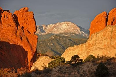
Pikes Peak is much more than a 14,115-foot heap of uplifted granite.
While appearing monolithic from a patio in town, it’s an amazingly complex mountain, with long sloping valleys, pine-studded hills, forbidding cliffs, hidden hollows and miles of wind-swept tundra and rocky spires, with views from the ‘purple mountain majesties ‘ to the ‘amber waves of grain. ‘
As a symbol and rallying cry of westward expansion and tourism for 150 years, the peak has a lot of stories to tell for those willing to step off Barr Trail, the hiker superhighway from Manitou Springs to the summit.
‘Look at all this country – how could you in a lifetime master this country? ‘ said Bob Houdek, designer of the Pikes Peak Atlas, who has been roaming and mapping the peak for 35 years. ‘There is some real rugged stuff in places nobody goes.
‘If you take any section and you look at it intensely, you are going to find trails that are not on any map. ‘
So this summer, lace up your hiking boots, clip in your mountain-biking shoes and go beyond Barr Trail to some of the peak’s greatest ‘secrets. ‘
Note: Some of these areas are made more accessible by the Pikes Peak Cog Railway, which is currently shut down. This article was originally written in 2013 when the Cog was still open.
Oil Creek Tunnel/ Ghost Town Hollow
In 1896, while Cripple Creek was booming with gold fever, speculators from the German National Bank of Cincinnati thought they had a good idea that gold could be found on the peak’s east face. So for several years, miners bored an adit 1,600 feet into granite at 11,800 feet.
Four miners died, the price of gold plummeted and the venture was abandoned, though the road the miners built became Elk Park Trail, one of the finer paths on the peak. In this secluded spot, towered over by high cliffs, you can enjoy the quiet and imagine what it must have been like to live and work here. You can almost sense the frustration and heartbreak these miners must have felt.
The mine has been sealed with a gate, but much of the equipment remains, as do the remnants of some cabins, a testament to the hardiness of these miners and to the lack of mine reclamation laws in the early 20th century.
To get there: The easiest way to reach the site is to drive the Pikes Peak Highway, park at the Elk Park trailhead, hike 2 miles, most of which is flat or downhill, and turn right at the sign. From Barr Trail, it’s a 4.5-mile up-and-down hike. Turn off just after Barr Camp. Bring an overnight pack, as the campsites along this stretch are some of the better spots to be found on Pikes Peak.
Mountain View (pending re-opening of Pikes Peak Cog Railway)
Located halfway up the Cog Railway line, on non-holidays you can buy a $12 hiker ticket and get dropped off here, saving your legs about 3,000 feet of climbing. Most people use this as a launching point for other adventures on the peak or as a shortened climb to the summit, but hike north for a few minutes and you’ll come to a clearing on the right.
Here on a gravelly knoll, you’ll see why the area is called ‘Mountain View, ‘ as the peak, Almagre Mountain in the distance and the entire region open up before you. It’s a great spot for a picnic or overnight camp, and tiny spring-fed creeks in the area flow most of the year for water to filter.
In the late 19th century, outfitters offered sunrise burro trips, in which tours camped at Mountain View until midnight and then headed along the train route to the summit to watch the sun rise over the plains. One contemporary likened the ride back down to Napoleon’s retreat from Moscow, with riders so exhausted they barely could stay in the saddle.
To get there: Take the Cog or hike up Barr Trail, turning left on trail No. 671 just before reaching Barr Camp.
Windy Point
Some of the oldest trees in the region can be found on this shoulder of Pikes Peak.
The Cog runs past here – but doesn’t stop – so you won’t have total solitude, but the vast expanse of the peak’s tundra is open for you to explore, with the Sangre de Cristo Mountains and other high peaks of the Rockies glittering in the distance.
Houdek said if you follow the faint trail running parallel with the train tracks, bring a good map and compass as the trail can be faint or nonexistent at times. Your reward, along with the views, is a spring flowing with water that, Houdek said, can be drank straight from the ground.
To get there: Follow the directions to Mountain View. Cross the tracks to the south and follow the trail west and uphill. Going east will take you onto closed Colorado Springs Utilities property.
Hurricane Canyon Research Natural Area
Hurricanes don’t hit Colorado, but in the 1920s or 30s a wind storm struck the eastern foothills of the peak with enough force to blow down all the trees. The area has two canyons, with steep slopes, boulder-covered canyon bottoms and loose rocky soil.
It became a designated natural research area in 1931. Though it’s less than a mile from U.S. Highway 24 west of Manitou Springs, few visit here for good reason.
Houdek describes the route up the canyon from the highway as hand-over-hand climbing, 1,000 feet in a quarter-mile, with drop-offs and caves ready to punish the misstep. But the rugged setting is worth it.
‘You feel like you’re deep in the Rocky Mountains even though you’re in the foothills, ‘ he said.
To get there: Houdek suggests appraching the area by hiking up Long Ranch Road and turning right on Forest Service Road 329 to the Fremont Experimental Forest. Head north on the French Creek Trail, No. 703.
Bottomless pit
Despite the name, this cirque below the summit does have a bottom, and if you make the effort to get there, you’ll see a side of Pikes Peak that looks more like Longs Peak than the gentle mountain we know and love.
There are many snow-climbing routes running more than 2,000 feet to the summit, but they aren’t for novices and are only climbable a couple of months a year. Use caution.
Thousands of people on the Pikes Peak Highway look down at the Bottomless Pit each year, but far fewer see this majestic cirque from below. In early summer, the ground is often a sea of wildflowers.
It’s also one of the more haunted places on the peak. Early Colorado Springs lore tells of a Ute woman, murdered by a jealous suitor, whose cries can be heard here. Another legend says a miner fell in the pit and on stormy nights his ghost walked along the edge, warning people to stay away, with a lantern that could be seen for miles.
To get there: Turn right on trail No. 632 from Barr Trail, a mile past Barr Camp, and follow into the pit.
Other gems
Sentinel Point: On the west flank of the peak, not visible from town, this pointy heap of boulders is actually the second-highest point in the Pikes Peak massif. Start at the trailhead for Horsethief Park along Colorado Highway 67, turn north on trail no. 708 and follow cairns to a ridge above timberline. Sentinel Point rises a short distance to the south. Get an early start as this route is very exposed if there are thunderstorms.
The Crater: Way off the beaten path, you’ll have to bushwhack to reach this depression in the earth at 11,500 feet, south of Cabin Creek. Houdek suggests approaching it from higher on the mountain, as a faint trail climbs into the valley from near Windy Point.
Cascade Mountain/Moore’s Park: A fantastic shuttle loop can be done from Cascade, through some of the peak’s more scenic and unvisited terrain, and back down Barr Trail into Manitou Springs. Follow the Heizer Trail from Cascade to the top of Cascade Mountain, head into open meadows and turn right below Manitou Reservoir (a left turn would take you to Hurricane Canyon) and take trail no. 638 as it winds up and down secluded valleys before joining Barr Trail.
Rocky Mountain: Hundreds of thousands climb the Manitou Incline each year, but relatively few venture on a little farther to the summit of Rocky Mountain, where an overlook offers stunning views of the peak. From the top of the Incline head uphill and follow the obvious route to the 9,250-foot overlook.


(0) comments
Welcome to the discussion.
Log In
Keep it Clean. Please avoid obscene, vulgar, lewd, racist or sexually-oriented language.
PLEASE TURN OFF YOUR CAPS LOCK.
Don't Threaten. Threats of harming another person will not be tolerated.
Be Truthful. Don't knowingly lie about anyone or anything.
Be Nice. No racism, sexism or any sort of -ism that is degrading to another person.
Be Proactive. Use the 'Report' link on each comment to let us know of abusive posts.
Share with Us. We'd love to hear eyewitness accounts, the history behind an article.