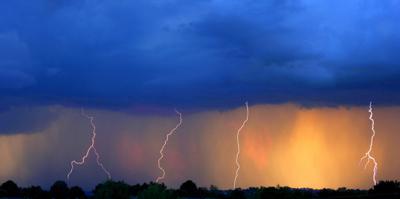
At 4:06 PM, the National Weather Service issued a severe thunderstorm warning for northeastern El Paso County. This warning currently lasts until 4:30 PM, though warnings are subject to change.
RELATED: Funnel cloud, hail spotted in Colorado
Their official warning indicates that quarter-sized hail is expected. Their warning also mentions that damage to vehicles is expected. It also states that a tornado is possible.
If you’re in the area, they recommend you get to the lowest floor of whatever structure you’re in and move to an interior room away from windows.
It’s also worth mentioning that there is a “red flag warning” in effect in much of the southern portion of the state, including places like Pueblo, Trinidad, and Westcliffe. See an updated map here. A red flag warning means that fire danger is high. In this case, it’s due to high winds, low humidity, and dry fuel.


(0) comments
Welcome to the discussion.
Log In
Keep it Clean. Please avoid obscene, vulgar, lewd, racist or sexually-oriented language.
PLEASE TURN OFF YOUR CAPS LOCK.
Don't Threaten. Threats of harming another person will not be tolerated.
Be Truthful. Don't knowingly lie about anyone or anything.
Be Nice. No racism, sexism or any sort of -ism that is degrading to another person.
Be Proactive. Use the 'Report' link on each comment to let us know of abusive posts.
Share with Us. We'd love to hear eyewitness accounts, the history behind an article.