


While the summer heat lays thick in the city, refreshing waters await around Colorado Springs and across the foothills.
Some destinations for your consideration:
North Cheyenne Cañon Park

Emma Acosta, 7, views leaves on a tree at Helen Hunt Falls in North Cheyenne Cañon Park.
You can opt to stay low, by the Starsmore Nature Center, and enjoy the creek that runs parallel to Lower Columbine Trail. Or you can go higher to Helen Hunt Falls, conveniently accessible by car.
Or go higher to the top parking lot, where you can reach the creek-touring Seven Bridges Trail. Farther on is St. Mary’s Falls. Visitors earn the cool spray of the cascade; at least you’ll have some shade for the roughly 6-mile out-and-back venture.
South Suburban ReservoirNear the base of North Cheyenne Cañon is Stratton Open Space. Starting from the parking lot and trailhead off Ridgeway Avenue, one can hike or ride a bike to this body of water that reflects the craggy majesty of Cheyenne Mountain. It’s popular among splashing dogs.
Seven Falls

The Ramagli family uses the cement walkway and hand rails at Helen Hunt Falls after an afternoon shower on Thursday, July 1, 2021. (The Gazette, Jerilee Bennett)
Locals often leave it for the tourists, who pay a fee to see it. The Broadmoor calls it “The Grandest Mile of Scenery in Colorado,” and the claim has merits — seven, to be exact. The silvery cascades rush down the canyon walls one after the other beside a staircase.
Catamount FallsThis is a small but mighty waterfall that tumbles over rocks beside Catamount Trail in Green Mountain Falls. It’s a rejuvenating break early along the trail, which continues to a splendid meadow called Garden of Eden.
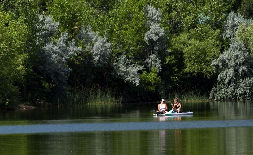
South Catamount Reservoir

South Catamount Reservoir. Photo by Seth Boster, The Gazette
The Catamount Trail leads to the reservoir, which is more commonly reached via the Pikes Peak Highway. The mountain looms over the water, surrounded by the woods where more trails roam. Many stay put with a fishing pole in hand. You’ll be hard-pressed to find a picnic spot with a better view.
Rampart Reservoir

Rampart Reservoir, with Pikes Peak in the background.
East of Woodland Park, high off Rampart Range Road, this is a go-to for boaters and anglers. If not by car, the Rainbow Gulch Trail is a great way to get to the reservoir. It’s an idyllic retreat through a stream-fed valley, before the trail circles the shores.
Manitou Lake

A boardwalk stretches through the wetlands of Manitou Lake, 7 miles north of Woodland Park.
It’s not the place Dr. William Bell envisioned in the 1870s — a world-class destination of hotels, casinos and horse stables. But maybe Manitou Lake is better as it is, largely left alone. The serene nook is tucked amid the pines north of Woodland Park. Views of Pikes Peak and the rocky face of Devil’s Head along the loop trail.
Colorado Springs lakes
In the city, we need not go far to enjoy water. Close to downtown, there’s Prospect Lake, where swimming is allowed Tuesdays, Thursdays and Saturdays, and where stand-up paddleboarding looks to be the most popular activity many days. To the south, there’s Quail Lake, another option for non-motorized boating.
Sinton Pond

From left, Scott Brown, Kyle Dick and his brother Garran Dick fish for bluegill at Sinton Pond near Fillmore and I-25 on Sunday. Gazette file
The description found in our Happy Trails series, spotlighting the region’s outdoors: “a surprising, wild oasis a stone’s throw from Interstate 25.” Melvin Sinton’s old homestead is now a city preserve hiding off the Pikes Peak Greenway. Along the short loop trail, people might rest under the shade with a book.
Palmer Lake
The dream of Colorado Springs founder Gen. William Jackson Palmer prevails: the hamlet to the north is a refreshing getaway for city dwellers.
You can hang by the lake in the heart of town, or venture a bit farther to the scenic reservoirs glistening by a steep trail.
Manitou Creek Path
In Manitou Springs, the mineral waters are the traditional way to cool down; they spout from wells around town. The Creek Path also does the trick. From Memorial Park, the path runs east, following Fountain Creek under the trees to the duck pond at Schryver Park and continues on sidewalk to splendid waterways in Fields Park.
Fountain Creek Regional Trail

Creek Path follows Fountain Creek through Manitou Springs. Gazette photo
At last visit, we caught the trail from the northwest side of Fountain Creek Regional Park, at the trailhead at the end of Duckwood Road. The creekside trail weaves beneath tall cottonwoods and past quaint ponds en route to the Fountain Creek Nature Center.


(0) comments
Welcome to the discussion.
Log In
Keep it Clean. Please avoid obscene, vulgar, lewd, racist or sexually-oriented language.
PLEASE TURN OFF YOUR CAPS LOCK.
Don't Threaten. Threats of harming another person will not be tolerated.
Be Truthful. Don't knowingly lie about anyone or anything.
Be Nice. No racism, sexism or any sort of -ism that is degrading to another person.
Be Proactive. Use the 'Report' link on each comment to let us know of abusive posts.
Share with Us. We'd love to hear eyewitness accounts, the history behind an article.