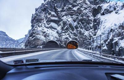
Less than two weeks after a big October storm rolled through the Centennial State, another big wave of snow is expected to hit Colorado. According to one model, the upcoming storm is currently predicted to drop up to 20 inches of powder, possibly more, this weekend.
Conditions from Monday through Friday are expected to be dry statewide, though widespread precipitation is expected to follow. According to Joel Gratz, of OpenSnow.com, totals from snowfall starting Saturday will likely fall in the 10 to 20-plus inch range, with highest totals favoring the southern mountains. Strong weekend winds are also likely to be present, particularly on Saturday, adding to the risk of high-elevation travel. Gratz also suspects that a Saturday to Sunday wave of snow could be followed by another wave of big snow from Sunday to Monday. Read his full, in-depth report here to get a look at where the snow is expected to land.
The National Weather Service is also predicting snowfall in Colorado, especially in the southwest corner of the state. The Red Mountain Pass area, which is near Telluride, Ouray, and Ridgway, is expected to see snow showers from Friday through Sunday, with periods of heavy snow possible. The National Weather Service is also calling for a widespread possibility of snow from Saturday through Sunday, spanning much of Colorado's mountainous region.
As far as the Front Range goes, expect less snow, as of now. The National Weather Service is currently calling for a chance of a rainy, snowy mix on Saturday night into Sunday in Denver, accompanied by above-freezing temperatures. Similar weather and slightly colder temperatures are expected to be present in Colorado Springs during the same period. Higher elevation areas in this region will likely see some accumulation.
Though hikers around the state reported relatively warm temperatures and dwindling snow on some of the state's highest peaks last weekend, this weekend's conditions are expected to be quite different. Colorado's most popular fourteener, Quandary Peak, is expected to be hit with 50 mile-per-hour wind, sub-freezing temperatures, and snow, starting Saturday. See the most up-to-date Quandary Peak forecast here.
If you're headed to the high country for skiing or hiking this weekend, be aware of the changing forecast and plan ahead accordingly. If you're hiking, bring adequate layers and traction and be prepared to turn back. Falling snow and gusting winds are likely to limit visibility and create deadly conditions.


(0) comments
Welcome to the discussion.
Log In
Keep it Clean. Please avoid obscene, vulgar, lewd, racist or sexually-oriented language.
PLEASE TURN OFF YOUR CAPS LOCK.
Don't Threaten. Threats of harming another person will not be tolerated.
Be Truthful. Don't knowingly lie about anyone or anything.
Be Nice. No racism, sexism or any sort of -ism that is degrading to another person.
Be Proactive. Use the 'Report' link on each comment to let us know of abusive posts.
Share with Us. We'd love to hear eyewitness accounts, the history behind an article.