
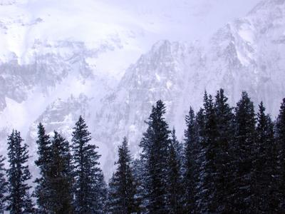
After multiple days of snowfall in Colorado, Mother Nature isn't done quite yet.
More snow is expected to fall in parts Colorado on Tuesday, with nearly a foot of fresh powder expected to land in parts of southern and southwest Colorado. Light snowfall is also expected to continue in other regions of the state.
The most snow is expected to land in the southwest San Juans, where up to 10 additional inches are in the forecast. Other spots in the southern Colorado region will see highs of 5 to 7 inches. As a result of the continued snow, several winter weather advisories remain in effect on Tuesday through the evening.
Moderate-heavy snow will continue across parts of southern CO this AM, slowly diminishing by early afternoon. Significantly reduced visibility & snow covered roads will create hazardous travel for AM commute. Dense fog can also be expected across El Paso CO this AM. #cowx pic.twitter.com/RbQmVPE74y
— NWS Pueblo (@NWSPueblo) January 26, 2021
According to the National Weather Service, the heaviest snow will most likely occur between 8:00 AM To 12:00 PM.
While the heaviest snow will favor the southwest San Juan Mountains, the eastern San Juans are expected to see 2 to 5 inches above 10,000 feet.
Up to 7 inches of snow could fall in the Sangre de Cristos, the Wet Mountains, the Pikes Peak region, and Teller and Fremont Counties.
Snow totals of 2 to 4 inches are also possible in the areas of Canon City, El Paso County, Pueblo, eastern Huerfano, and Western Las Animas, Otero, Eastern Las Animas, Bent, Prowers, and Baca Counties.
Travel in impacted areas could be very difficult, especially along the I-25 and Highway 50 corridors. Patchy blowing snow could significantly reduce visibility at times. According to the National Weather Service, the hazardous conditions could impact the morning and evening commutes.
If you must travel, keep an extra flashlight, food, and water in your vehicle in case of an emergency. Here’s a list of a few basic items that should be kept in your trunk during the winter months.
It's also worth noting that more snow is expected to soon follow this drop. Joel Gratz of OpenSnow is predicting another 2 to 10 inches from Friday evening through Saturday after a dry couple of days. Read his full report in detail here.
Editor's Note: All weather statements are subject to change. See OpenSnow's full forecasting map, specific resort predictions, and more here. Check CDOT’s Facebook, Twitter (@coloradodot) or cotrip.org for closures and delays on highways and roads across Colorado.


(0) comments
Welcome to the discussion.
Log In
Keep it Clean. Please avoid obscene, vulgar, lewd, racist or sexually-oriented language.
PLEASE TURN OFF YOUR CAPS LOCK.
Don't Threaten. Threats of harming another person will not be tolerated.
Be Truthful. Don't knowingly lie about anyone or anything.
Be Nice. No racism, sexism or any sort of -ism that is degrading to another person.
Be Proactive. Use the 'Report' link on each comment to let us know of abusive posts.
Share with Us. We'd love to hear eyewitness accounts, the history behind an article.