
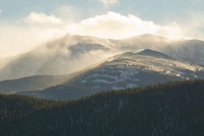
While this summer has been a hot one in Colorado, things are about to cool down enough to make snow possible on some of Colorado's highest peaks in upcoming days.
According to forecasters at Bouldercast Weather, snowfall will likely take place over the next few days as a colder weather system moves through the state.
Here's a look at what they're predicting to land where through next Tuesday:
It's also worth noting that multiple peaks around the state were predicted to get snowfall on Saturday morning, Including Mount Antero, which was predicted to get up to .8 inches and Mount Elbert, which was predicted to .4 inches. The Mount Elbert area is also forecast to get a little more snow on Monday and Tuesday. This snow comes as temperatures on Colorado's highest peaks are starting to dip below freezing at times.
The snow might not be much, but this shift is something for high-altitude hikers to be aware of. Be warned that even a little bit of snow on a high-altitude peak can make conditions much more dangerous, as temperatures drop and ice appears. If colder temperatures are predicted during your climb or cold temperatures have been present in recent days, pack layers and bring a reliable traction option.


(0) comments
Welcome to the discussion.
Log In
Keep it Clean. Please avoid obscene, vulgar, lewd, racist or sexually-oriented language.
PLEASE TURN OFF YOUR CAPS LOCK.
Don't Threaten. Threats of harming another person will not be tolerated.
Be Truthful. Don't knowingly lie about anyone or anything.
Be Nice. No racism, sexism or any sort of -ism that is degrading to another person.
Be Proactive. Use the 'Report' link on each comment to let us know of abusive posts.
Share with Us. We'd love to hear eyewitness accounts, the history behind an article.