
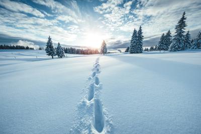
In case you haven’t heard, big snow is about to roll into Colorado in the form of 10 to 20+ inches in some spots, according to OpenSnow. This storm is projected to last from Wednesday through Thursday night.
Spots likely to get the most powder will be Aspen, Crested Butte, and Monarch, with Aspen Snowmass showing 33 inches forecasted over the next 5 days.
This storm will likely be followed by another decent storm on Friday, as well as another dumper early next week. Read OpenSnow’s full in-depth report here.
In lower elevations around the state, little snow is expected.
Colorado Springs will be mostly dry for the next week, with temperatures in the 40s and 50s.
Denver will be a little cooler, likely in the upper 30s and 40s, with a good chance of rain on Friday.
Things will be a bit wetter on the Western Slope, with a high chance of rain in Grand Junction through early Saturday.


(0) comments
Welcome to the discussion.
Log In
Keep it Clean. Please avoid obscene, vulgar, lewd, racist or sexually-oriented language.
PLEASE TURN OFF YOUR CAPS LOCK.
Don't Threaten. Threats of harming another person will not be tolerated.
Be Truthful. Don't knowingly lie about anyone or anything.
Be Nice. No racism, sexism or any sort of -ism that is degrading to another person.
Be Proactive. Use the 'Report' link on each comment to let us know of abusive posts.
Share with Us. We'd love to hear eyewitness accounts, the history behind an article.