
"It's gonna be a disaster," speculates one commenter under a Facebook post that features a viral article from a major Denver media company that frames a route as a "secret, unsafe shortcut around I-70" amid mudslide-related detours on the road.
Editor's Note: Due to serious travel and safety concerns posed by traffic moving through these backcountry routes, we won't be linking to the mentioned article nor will we be including the name of other backcountry routes causing problems related to I-70. Use the official detour!
According to the piece, "locals call [the pass] a lifeline," with parts of the road not paved, other sections quite narrow, and steep and dangerous drop-offs aplenty. According to a representative of Eagle County Roads and Bridges, the pass was previously taken off of Google Maps and Apple Maps as an option for thru-traffic.
The piece about the route has since been picked up by several national media sources, including Yahoo, further publicizing the dangerous detour. Many online readers have expressed concern that publicizing the route may lead to traffic issues, as well as making the route difficult for locals to utilize during daily life.
The Eagle County Sheriff's Office doesn't seem to have issue with the piece, sharing it on their Twitter without comment.
Meanwhile, the Pitkin County Sheriff's Office has made a desperate plea on Twitter for travelers to stick to Highway 13 through Kremmling as an I-70 detour, reminding the public that this is the "ONLY" official alternative route. The Pitkin County Sheriff's Office reminder came after a different mountain pass was forced to close due to a disabled vehicle.
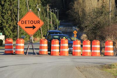
With I-70 through Glenwood Canyon closed for the foreseeable future, many travelers are on the hunt for shortcuts that may help them skip a four-hour detour that is recommended by the Colorado Department of Transportation. That being said, as many Coloradans already know, just because a mountain road can be found on a map, doesn't mean it's passable by all vehicles. It's also worth noting that many of these mountain roads can't handle much traffic well.
Travelers are advised to avoid taking any possible detour aside from the one recommended by the Colorado Department of Transportation. This detour utilizes Colorado 13, Colorado 40, and Colorado 9, traveling through Meeker, Steamboat Springs, and Kremmling.
To Colorado's visitors and other travelers, alike – while backroads might look like a feasible option on Google Maps, many of these backroads are not maintained and can require serious driving ability, along with the right vehicle for the job. In addition to complications posed by the terrain, cell reception is quite limited in many of these mountainous areas. This can make finding help difficult if needed. On top of that, getting a tow from these roads can be quite complicated and many are very narrow, meaning a breakdown can block traffic.
Stick to the pavement when looking for a detour if unfamiliar with where you're headed.
STAY INFORMED: Sign-up for the daily OutThere Colorado newsletter here


(0) comments
Welcome to the discussion.
Log In
Keep it Clean. Please avoid obscene, vulgar, lewd, racist or sexually-oriented language.
PLEASE TURN OFF YOUR CAPS LOCK.
Don't Threaten. Threats of harming another person will not be tolerated.
Be Truthful. Don't knowingly lie about anyone or anything.
Be Nice. No racism, sexism or any sort of -ism that is degrading to another person.
Be Proactive. Use the 'Report' link on each comment to let us know of abusive posts.
Share with Us. We'd love to hear eyewitness accounts, the history behind an article.