
Snow is starting to stack up in Colorado, with well over a foot of powder predicted to fall. While some Coloradans may dread slick roads and early season snow, many are hoping this snowstorm will help slow the growth of the Cameron Peak Fire. This blaze is burning in Rocky Mountain National Park, recently exploding past 100,000 acres.
The snowfall is currently predicted to intensify throughout the day, continuing into the night and early Wednesday for much of the state.
Here's a look at what's landed so far around the state.
A roundup of cams showing the arrival of winter this morning. The heaviest snow is now falling along/west of a line from Cheyenne, WY to Rocky Mountain National Park and Kremmling, CO. That heavier snow shifts eastward later this afternoon and evening. #COwx pic.twitter.com/VoANNimoVi
— NWS Boulder (@NWSBoulder) September 8, 2020
6” of #snow near Manila and Flaming Gorge. #utwx ❄️ pic.twitter.com/FH9V2OfTOU
— Chase Thomason (@ChaseThomason) September 8, 2020
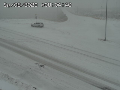
Snow covered roadways just south of Estes Park, Colorado this morning. Snowfall is coming down pretty good! #cowx @NWSBoulder @CharlesPeekWX @JimCantore pic.twitter.com/Aky9W7FlDI
— Zachary Hall (@WxZachary) September 8, 2020
Mostly snow falling now falling in Fort Collins and Loveland. A mix of light rain/snow in the Denver metro area. #COwx https://t.co/lQALmB3789
— NWS Boulder (@NWSBoulder) September 8, 2020
SNOW STORM underway in the Colorado Foothills with an inch of snow on the grass in Genesee CO! Roads are mainly wet this morning. Heavier snow moves in this PM. #SMO #cowx @RadarOmega_WX pic.twitter.com/yR3Fa30Roi
— Reed Timmer (@ReedTimmerAccu) September 8, 2020
After hours of early morning snow, it’s finally starting to stick to the cars. A total of 6-10” is possible by the time all is said and done in Highlands Ranch, Colorado.#COwx #snow
— Zach Covey (@ZachCoveyTV) September 8, 2020
🎥 Kaylee Heck pic.twitter.com/m9QwZxqjdD
6” of #snow near Manila and Flaming Gorge. #utwx ❄️ pic.twitter.com/FH9V2OfTOU
— Chase Thomason (@ChaseThomason) September 8, 2020
8:52 AM: Light rain/snow mix along the I-25 Corridor. We may not see transition to all snow until heavier precip late this afternoon/eve. That's when more significant snow will stick on vegetation & elevated surfaces. Tree damage & scattered power outages possible tonight. #COwx pic.twitter.com/20XFDtGnWX
— NWS Boulder (@NWSBoulder) September 8, 2020
#NoCo yesterday vs today!! Yesterday, apocalyptic ash, today #snow Praise #MotherNature for this, hopefully will help squash our fires! #cowx @MattMakens @CReppWx @KathySabine9 #ColoradoFires #ColoradoSnow #coloradoweather #CameronPeakFire pic.twitter.com/9ZA3Lu9XW1
— Lisa Hewitt (@COplantlady) September 8, 2020
Winter is here! Latest pic from just east of Rabbit Ears Pass. #COwx pic.twitter.com/k3ibke4Voq
— NWS Boulder (@NWSBoulder) September 8, 2020


(0) comments
Welcome to the discussion.
Log In
Keep it Clean. Please avoid obscene, vulgar, lewd, racist or sexually-oriented language.
PLEASE TURN OFF YOUR CAPS LOCK.
Don't Threaten. Threats of harming another person will not be tolerated.
Be Truthful. Don't knowingly lie about anyone or anything.
Be Nice. No racism, sexism or any sort of -ism that is degrading to another person.
Be Proactive. Use the 'Report' link on each comment to let us know of abusive posts.
Share with Us. We'd love to hear eyewitness accounts, the history behind an article.