
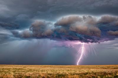
Much of Colorado's Front Range and Eastern Plains regions are expected to see precipitation on Friday afternoon, with additive risk factors likely to be present in some areas.
According to the National Weather Service, around 1 PM, storms are expected to start developing over El Paso County, moving southeast toward Lamar, intensifying along the way. The storms are expected to be most severe on the Eastern Plains through around 9 PM when the storms will cross into Kansas.
The most prominent risks will be hail up to 1.25 inches in diameter (half dollar-size) and winds up to 60 miles per hour. The risk of a tornado with Friday's storms is now low, as is the risk of flooding on the plains.
Along the Front Range, rain showers and thunderstorms are expected to develop during the afternoon amid warm temperatures. Mountain weather is expected to be mostly dry.
In areas where heavy rain is present, watch out for flash flooding. This can be particularly dangerous in areas where a burn scar exists, especially when these areas are near roadways or areas where foot traffic is present.
For the most up-to-date information, check out the National Weather Service website, Facebook page, and Twitter.


(0) comments
Welcome to the discussion.
Log In
Keep it Clean. Please avoid obscene, vulgar, lewd, racist or sexually-oriented language.
PLEASE TURN OFF YOUR CAPS LOCK.
Don't Threaten. Threats of harming another person will not be tolerated.
Be Truthful. Don't knowingly lie about anyone or anything.
Be Nice. No racism, sexism or any sort of -ism that is degrading to another person.
Be Proactive. Use the 'Report' link on each comment to let us know of abusive posts.
Share with Us. We'd love to hear eyewitness accounts, the history behind an article.