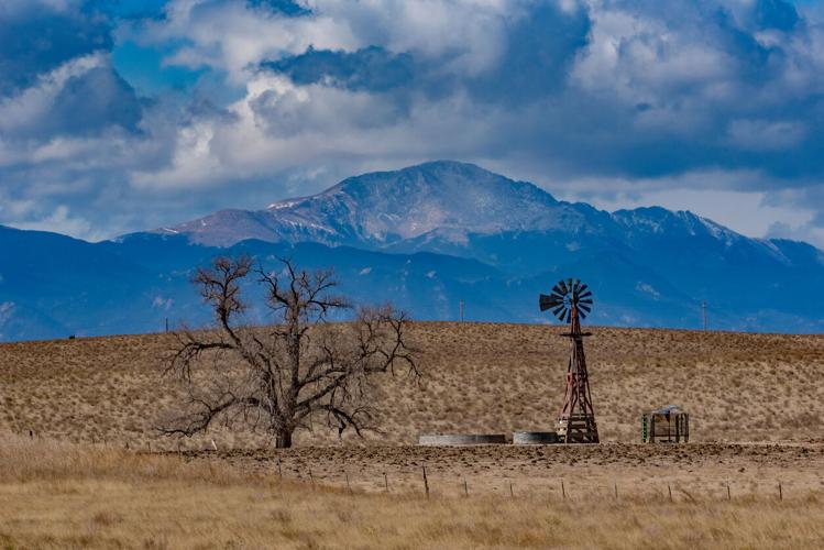
Those familiar with climbing Colorado's high elevation peaks are likely used to spotting discrepancies between sources when it comes to the measurement of a mountain's height. For example, one guidebook might say Pikes Peak, also known as America's Mountain, reaches 14,110 feet above sea level, while an online resource might put the same mountain at 14,115 feet. Pikes Peak isn't the only mountain where this discrepancy exists either – start paying attention while planning your next climb and you'll find many more examples without even leaving Colorado.
When it comes to this confusion, two big factors seem to be at play – first, that mountains can actually shrink and grow over time and second, that as technology improves, the ability to accurately analyze terrain does, as well. The constantly evolving nature of information related to a mountain's height seems to create a persistent obstacle when it comes to finding the most accurate answer to the question – "how tall is that mountain?"
Granted, does that answer really matter?
Not only does being able to accurately determine the height of a mountain allow us to track how the world may be changing around us, it also provides a window into how technology is improving, with the measurement of a mountain being one of countless applications of satellite imagery tech. Plus, people need some sort of semi-accurate number to put on their cardboard summit signs, right?
Let's look at two reasons the listed height of a mountain can change:
1. Physical changes
While major changes taking place on mountains may rarely be witnessed, they do occur. Mountains can get taller, shorter, and can undergo other changes related to their shape.
In terms of getting taller, Earth's tectonic plates continue to shift. When this happens, they can collide with each other, creating uplift of a land mass. While an initial uplift may form a peak or range relatively quickly, as plates continue to collide, additional uplift can continue take place over time. Alaska's Mount Denali, for example, is said to be growing by about 0.4 inches each year despite forming an estimated 60 million years ago.
The collision of tectonic plates can also push magma to the surface, forming volcanic peaks through the process of subduction – when an oceanic plate slides under a continental one.

Schematic Cross Section of a Typical Subduction Zone: When tectonic plates converge (illustrated by the thick black arrows on either side of the image), one plate slides beneath the upper plate, or subducts, descending into the Earth’s mantle at rates of 2 to 8 centimeters (1–3 inches) per year (red-brown slab with skinny arrow shows direction of motion). (Public domain.)
Natural disasters, specifically earthquakes, are also known to impact peak size. Author John Green once cited a 2015 earthquake in Nepal that resulted in some local peaks growing, while others reportedly shrunk 23 inches within five seconds.
Earthquakes aren't the only factor that can result in a mountain shrinking, either. Mountains are also up against erosion related to wind and rain – particularly effective at shortening a peak after initial growth has slowed. This can be seen in how newer ranges tend to be more jagged compared to older ranges that have already faced an extended period of erosion.
One incredible example of this is reported to be found in North America's Appalachians. A range once said to rival the height of Himalayan peaks – well above 20,000 feet of elevation – they've since eroded to be less than 7,000 feet tall over the past 200 million years ago.
In other words, peaks are constantly changing and one metric where this is reflected is in their height. Don't be surprised if the reason two sources vary is because each piece of data was published according to what was actually accurate at the time.
2. Improvements in measurement
Perhaps one of the best examples of how better technology can change the understood height of a mountain is found with Pikes Peak. Now determined to be 14,115 feet tall following actions by Congress in 2002, many other heights of the mountain have been proposed over time.
One timeline published by Pikes–Peak.com states that Zebulon Montgomery Pike first estimated that the mountain was 18,000 feet in elevation in 1806. It was later listed as 14,500 feet in 1859 and then 14,216 feet in 1875. More changes would happen in 1891, when Pikes Peak was measured at 14,147 feet, though some also claimed that 14,336 feet was its height during the same year. A USGS measurement finally gave the peak an official height of 14,107 feet in 1907, though this would change several more times before the current 14,115-foot measurement was adopted. The latest change was an increase of five feet from a height of 14,110 feet that had been measured in 1963.
Throughout all of the changes above, the actual size of Pikes Peak wasn't making the massive and rapid leaps depicted in the varied measurements. Instead, what was changing was measurement technology. While the math behind how a mountain is measured stayed the same, improved tools and the development of satellite imaging have bettered terrain analysis, thus, also the ability to measure a peak.
In other words, technology tends to improve overtime, able to better perform the job its designed to do. Don't be surprised if the reason two sources vary is because each piece of data was published at a time when different technology with different capabilities was being used.
Generally, minor changes to the height of a mountain probably don't matter much in the immediate term. However, in Colorado, that's not the case – particularly as it relates to Colorado's fourteener climbing community.
Because of all these ongoing changes, it makes it possible for Colorado to gain or lose fourteeners, either due to a peak actually changing or merely a more accurate measure being taken. Consider Sunshine Peak, for example. Sources have put the mountain somewhere between 14,001 and 14,007 feet in recent years – could a new measurement result in the mountain losing its 'fourteener' status? It sure seems like a possibility.
It's also worth noting that additional uplift or better measuring could eventually mean new fourteeners get added to the list, too, with several thirteeners within 20 feet of gaining fourteener status. Could it even be possible for shifting plates or a correction to push Mount Massive past Mount Elbert, meaning a new highest point for Colorado? Time will tell.
Granted, people can't decide on the true number of fourteeners now and they probably won't be able to agree on an answer to that question in the future – could historical status on the fourteener list earn a peak a permanent spot despite some shrinkage? Either way, just climb the mountain regardless of its official height and enjoy the good views and the adventure found along the way.
STAY INFORMED: Sign-up for the daily OutThere Colorado newsletter here


(0) comments
Welcome to the discussion.
Log In
Keep it Clean. Please avoid obscene, vulgar, lewd, racist or sexually-oriented language.
PLEASE TURN OFF YOUR CAPS LOCK.
Don't Threaten. Threats of harming another person will not be tolerated.
Be Truthful. Don't knowingly lie about anyone or anything.
Be Nice. No racism, sexism or any sort of -ism that is degrading to another person.
Be Proactive. Use the 'Report' link on each comment to let us know of abusive posts.
Share with Us. We'd love to hear eyewitness accounts, the history behind an article.